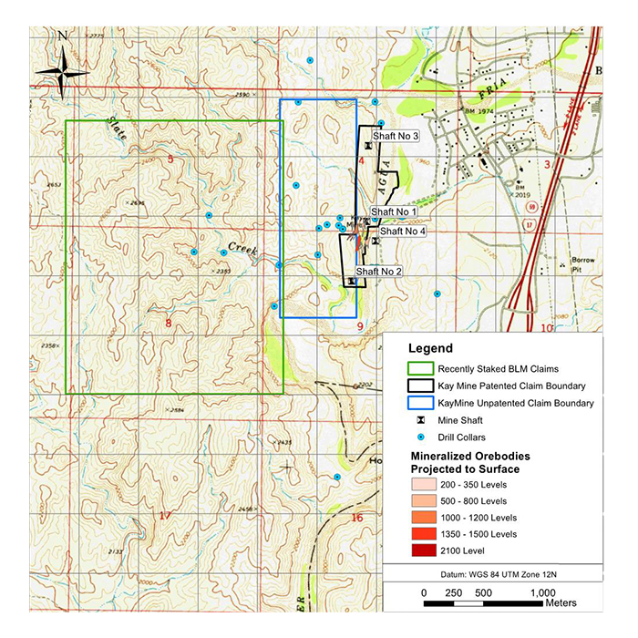
Claim Map

- Located 45 miles north of Phoenix in the Yavapai County, Arizona
- Kay deposit host stratigraphy has been traced over 5,600 feet at surface with only 25% (1,400 feet of strike) drill tested
- Mineralization consists of two steeply dipping massive sulfide bodies
- In 1982, it was estimated the Kay Mine hosted 5.8Mt at 5.8% CuEq (2% CuEq cut-off grade)
- Historic resource located on 70 acres of patented (private) claims with no royalties
* The historical estimates for the Kay Mine and Sugarloaf Peak Projects predate and are unclassified and not compliant with NI 43-101 guidelines. Significant data compilation, re-drilling, re-sampling and data verification may be required by a Qualified Person before the historic resource can be verified and upgraded to be compliant with current NI 43-101 standards. The Company’s QP has not yet undertaken sufficient work to classify the historic estimate as a current resource and the Company is not treating the historic estimate as a current resource
